Skip to content
Search site
Northeast Tech -
Search site
Explore
Explore
Translate
Explore
Translate
About
Show submenu for About
About
About Us
Show submenu for About Us
Consumer Information
Financial Reporting
District Strategic Plan
School Calendar
Staff Directory
Administration Office
Business & Industry Services at MidAmerica
Business & Industry Services at Grand Lake
Afton Campus
Claremore Campus
Kansas Campus
Pryor Campus
Human Resources
Show submenu for Human Resources
Job Opportunities
Employee Resources
Workforce Training Hub
Northeast Tech Foundation
Show submenu for Northeast Tech Foundation
Board Members
Foundation Scholarship Application
Donate to the Foundation
School Board
Show submenu for School Board
Board Meeting Dates
Board Meeting Agendas & Minutes
Board Members
Board Policies
Subscribe to Notifications
Contact Us
NT Insider (Employees Only)
High School
Show submenu for High School
High School
Full-Time Programs
Show submenu for Full-Time Programs
Afton Campus
Claremore Campus
Kansas Campus
Pryor Campus
Full-Time Course Catalog
Apply Now
Driver Education
Adults
Show submenu for Adults
Adults
Short-Term Classes
Show submenu for Short-Term Classes
Adult Education Course Catalog
Adult Education Short-Term Classes Online Registration
Short-term Courses through Ed2Go
Career Training Courses through Ed2Go
Adult Cosmetology
Lineman Training
Practical Nursing
Truck Driver Training
Full-Time Programs
Show submenu for Full-Time Programs
Afton Campus
Claremore Campus
Kansas Campus
Pryor Campus
Full Time-Course Catalog
13th Year Opportunities
Business and Industry Services
Show submenu for Business and Industry Services
Business and Industry Services
BIS Overview
Register for Training
Register for Training
Business Incubator
Safety Training
Industrial Maintenance
Show submenu for Industrial Maintenance
AC/DC Electrical Theory
Basic & Laser Shaft Alignment
Electrical & Electronics Technology
Hydraulics
HVAC
Ladder Logic & Motor Controls
Mechanical Drives
Pneumatics
Programmable Logic Controllers (PLCs)
Vibration Analysis
Rescue Training Center
Show submenu for Rescue Training Center
Hazardous Waste Site Worker
Hazmat Courses
Industrial Rope Access Technician I/II & III
Confined Space Courses
Atmospheric Rescue Technician (ART)
Team Skills Assessment (TSA)
Individual Skills Assessment (ISA)
Agriculture Business Management
Organizational Leadership & Development
Business Development
Technology Training
Student Resources
Show submenu for Student Resources
Student Resources
Admissions
Student Services
Show submenu for Student Services
Career Readiness Center
College Connection
Student Organizations
HESI Practice Exam
Transcript Requests
Show submenu for Transcript Requests
Full-Time Transcript Request
Practical Nursing Transcript Request
Quick Links
Show submenu for Quick Links
Moodle
Student GMail
Viewbook
Zoom
Student Handbook
Show submenu for Student Handbook
Student & Parent Handbook Portal
Job Board
Staff-to-Student Communication
Campus Safety
Financial Aid
Show submenu for Financial Aid
Financial Aid
FAFSA/PELL Information
Scholarships
Net Price Calculator
Resources
Show submenu for Resources
Financial Aid Policies & Procedures
Job Placement Formula
Additional Resources
Financial Aid Forms
Eligible Career Pathways
Public Disclosures for Higher Education Emergency Relief Funds (HEERF) Grants to Students
Contact Us
More
Show submenu for
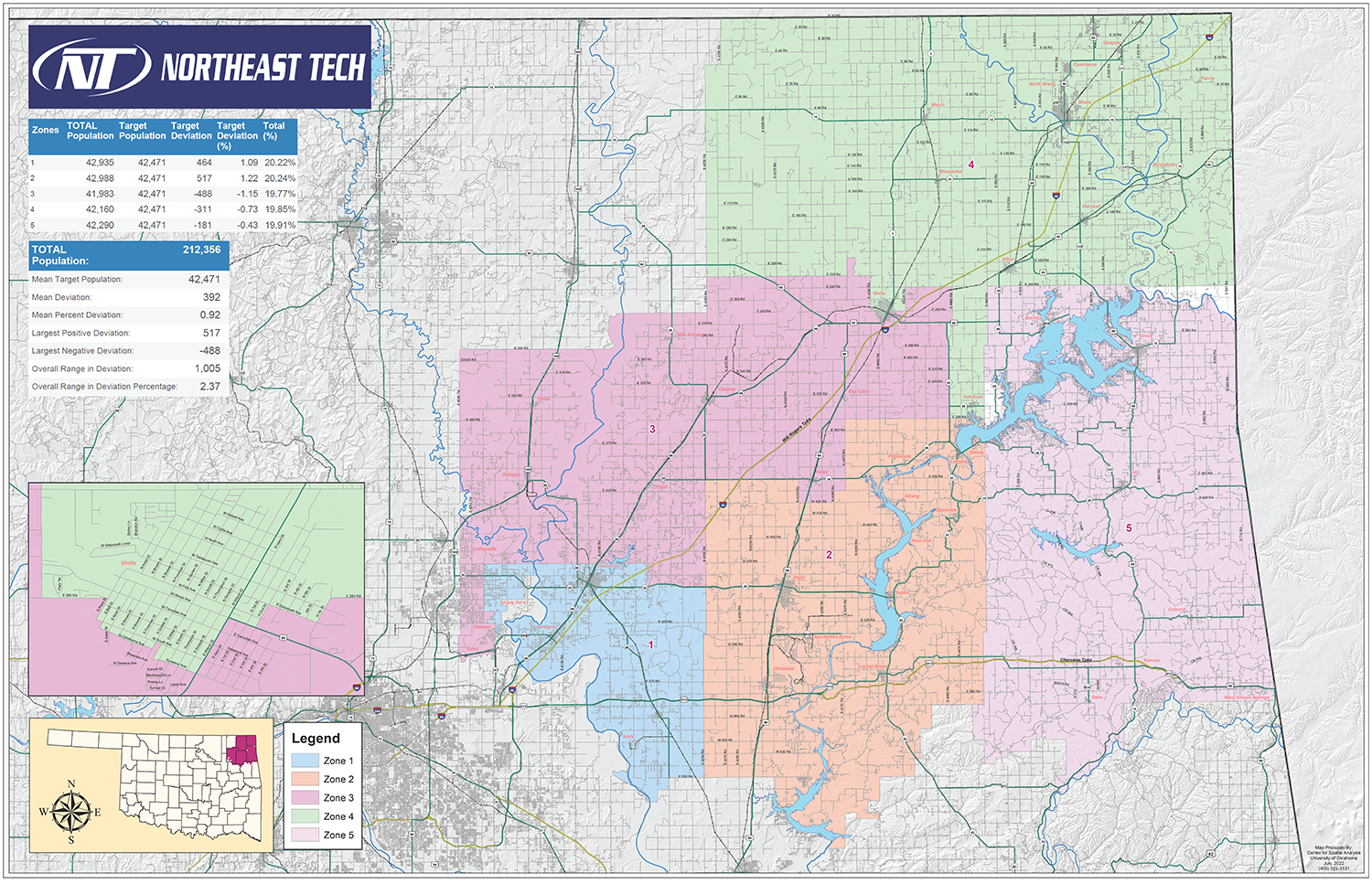
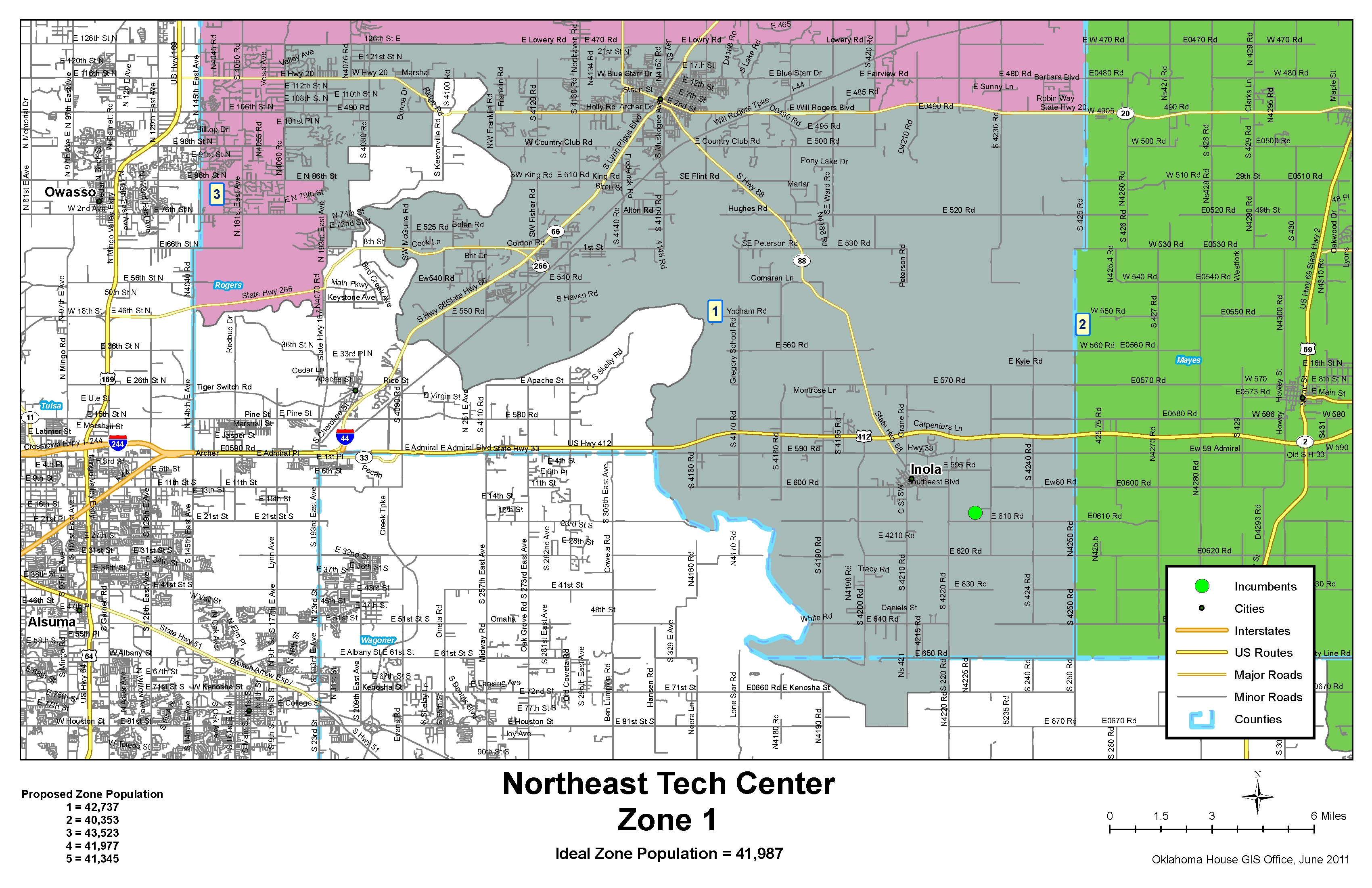
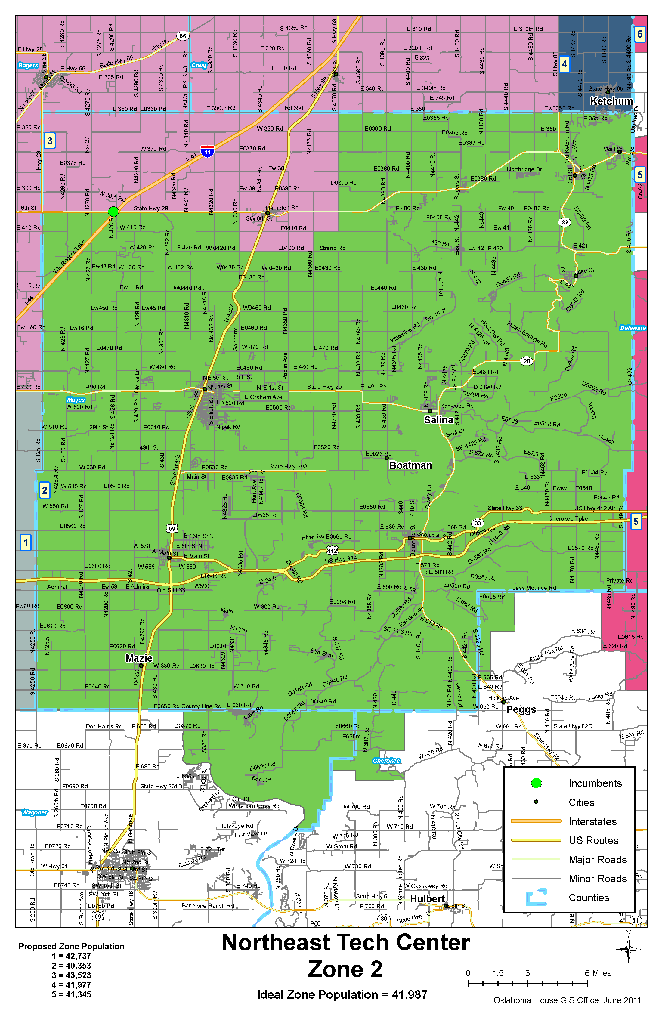
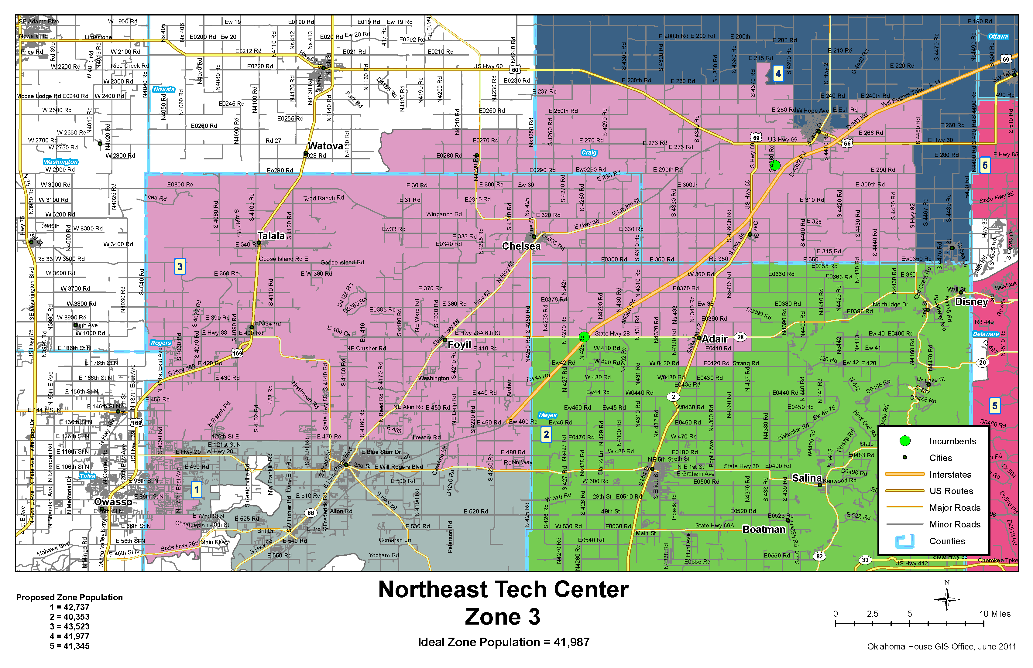
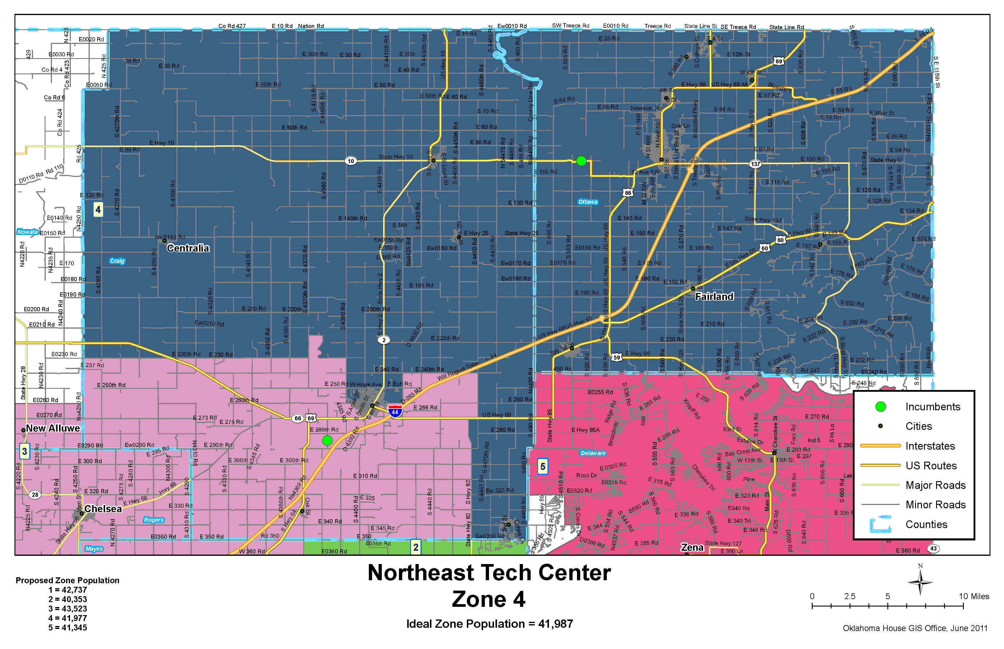
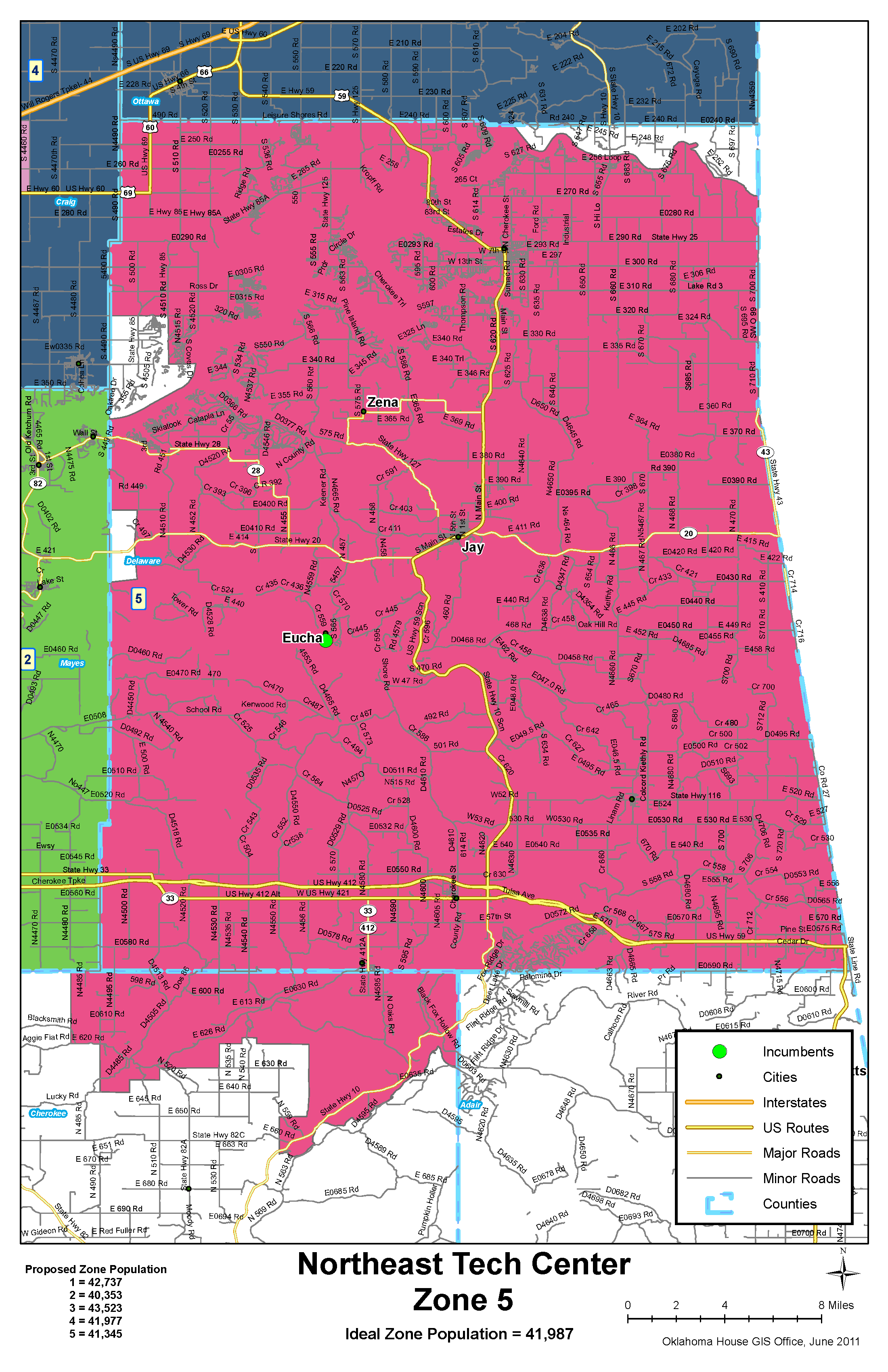
District Maps